德弗里瑟梅倫[編輯]
外觀
| 德弗里瑟梅倫 De Friese Meren De Fryske Marren | |
|---|---|
| 市鎮 | |
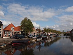
 流經約勒的運河 | |
 在菲士蘭的位置 | |
| 坐標:52°58′N 5°47′E / 52.967°N 5.783°E | |
| 國家 | |
| 省份 | 菲士蘭省 |
| 成立 | 2014年1月1日[1] |
| 政府[2] | |
| • 行政機構 | 市議會 |
| • 市長 | Arie Aalberts (基督教民主呼籲) |
| 面積[3] | |
| • 總計 | 549.10 平方公里(212.01 平方英里) |
| • 陸地 | 361.83 平方公里(139.70 平方英里) |
| • 水域 | 187.27 平方公里(72.31 平方英里) |
| 海拔[4] | 2 公尺(7 英尺) |
| 人口(2021年)[5] | |
| • 總計 | 51,778人 |
| 時區 | CET(UTC+1) |
| • 夏時制 | CEST(UTC+2) |
| 郵政編碼 | Parts of 8400 and 8500 range |
| 電話區號 | 0513, 0514 |
| 網站 | www |
德弗里瑟梅倫(荷蘭語:De Friese Meren;西菲士蘭語:De Fryske Marren;意為「菲士蘭的湖」)是荷蘭北部的一個市鎮,位於菲士蘭省。該市鎮成立於2014年1月1日,是由哈斯特蘭-斯洛滕、萊姆斯特蘭、斯哈斯特蘭、博倫斯特海姆的部分地區合成而成[1][6]。
參考文獻
[編輯]- ^ 移至: 1.0 1.1 Herindeling [New subdivisions]. Uitvoeringsorganisatie De Friese Meren. [2013-08-25]. (原始內容存檔於2013-09-04) (荷蘭語).
- ^ College B&W [Board of mayor and aldermen]. Gemeente De Friese Meren. [2014-01-16]. (原始內容存檔於2014-01-18) (荷蘭語).
- ^ Kerncijfers wijken en buurten [地區關鍵統計數字]. 荷蘭中央統計局統計數據. 荷蘭中央統計局. 2013-07-02 [2014-03-12] (荷蘭語).
- ^ Postcodetool for 8501AA. Actueel Hoogtebestand Nederland. Het Waterschapshuis. [2013-08-25]. (原始內容存檔於2013-09-21) (荷蘭語).
- ^ Bevolkingsontwikkeling; regio per maand [Population growth; regions per month]. CBS Statline. CBS. 2022年1月1日 [2022年1月2日] (荷蘭語).
- ^ Wet van 19 juni 2013 tot wijziging van de gemeentelijke indeling in een deel van de provincie Fryslân [Act of 19 June 2013 to change the municipal division in a part of the province of Fryslân]. Act No. 286 of 2013-06-19. [2013-08-26] (荷蘭語). 存档副本. [2018-02-05]. 原始內容存檔於2018-01-24.


