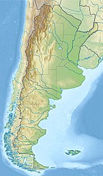
邁波火山
外觀
| 邁波火山 | |
|---|---|
 邁波火山的衛星影像 | |
| 最高點 | |
| 海拔 | 5,264米[1] |
| 座標 | 34°09′39.6″S 69°49′58.8″W / 34.161000°S 69.833000°W |
| 地理 | |
| 位置 | 阿根廷、智利 |
| 所屬山脈 | 安第斯山脈 |
| 地質 | |
| 山脈類型 | 層狀火山 |
| 最近噴發 | 1908年 |
| 攀山 | |
| 首次登頂 | 1883年 |
邁波火山(Volcán Maipo)是阿根廷和智利接壤安第斯山脈的層狀火山,位於圖蓬加托火山以南90公里和聖地亞哥東南100公里,高度5,264米,是安第斯山脈最南部的5,000米高山。相對於北部相同高度的山峰,邁波火山有較多永久積雪。
參考文獻
[編輯]- Volcan Maipo or Maipú (span.) [1]
- Maipo. 全球火山作用計劃. 史密森尼學會.
- Sruoga, P.; Llambías, E.J., Fauqué, L., Schonwandt, D., and Repol, D.G. Volcanological and geochemical evolution of the Diamante Caldera-Maipo volcano complex in the Southern Andes of Argentina (34°10’S). J. South American Earth Sci. 2005, 19: 399–414.
- ^ The given height is supported by SRTM data. Higher elevations given by some other authorities are incorrect.
| 這是一篇與智利相關的小作品。您可以透過編輯或修訂擴充其內容。 |
| 這是一篇與阿根廷相關的小作品。您可以透過編輯或修訂擴充其內容。 |

