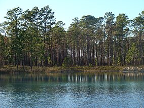
阿巴拉契科拉国家森林
外观
| Apalachicola National Forest | |
|---|---|
IUCN分类VI(资源管理保护区) | |
 | |
| 位置 | 美国佛罗里达州 |
| 最近城市 | 佛罗里达州塔拉哈西 |
| 坐标 | 30°14′10″N 84°39′56″W / 30.23611°N 84.66556°W |
| 面积 | 632,890英亩(2,561.2平方千米)[1] |
| 创造 | 1936年5月13日[2] |
| 管理机构 | 美国国家森林局 |
| 网站 | Apalachicola National Forest |
阿巴拉契科拉国家森林(英语:Apalachicola National Forest)是美国的一处国家森林,1936年5月13日建立,位处弗罗里达州境内,占地面积约632,890英亩(2,561.2平方千米),最近的城市为塔拉哈西。
参考资料
[编辑]- ^ Land Areas of the National Forest System (PDF). U.S. Forest Service. (原始内容存档 (PDF)于2013-01-16).
- ^ Proclamation 2169, 49 Stat. 3516 (May 13, 1936).
外部链接
[编辑]维基共享资源上的相关多媒体资源:阿巴拉契科拉国家森林
 维基导游上有关阿巴拉契科拉国家森林的旅行指南
- Apalachicola National Forest (页面存档备份,存于互联网档案馆) official site at United States Forest Service
- The Florida Trail in the Apalachicola National Forest
- Field Guide to Flora in Apalachicola National Forest (页面存档备份,存于互联网档案馆)
| 这是一篇与美国地理相关的小作品。您可以通过编辑或修订扩充其内容。 |

