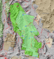
File:Death Valley NP master map.png
外觀

預覽大小:546 × 599 像素。 其他解析度:219 × 240 像素 | 437 × 480 像素 | 853 × 936 像素。
原始檔案 (853 × 936 像素,檔案大小:951 KB,MIME 類型:image/png)
檔案歷史
點選日期/時間以檢視該時間的檔案版本。
| 日期/時間 | 縮圖 | 尺寸 | 使用者 | 備註 | |
|---|---|---|---|---|---|
| 目前 | 2009年1月1日 (四) 21:59 |  | 853 × 936(951 KB) | Mahahahaneapneap | Compressed |
| 2006年3月9日 (四) 01:30 |  | 853 × 936(1.22 MB) | Mav | Map created by Daniel Mayer using data from the National Park Service [http://science.nature.nps.gov/nrdata/metadata.cfm?ID=16872 metadata] |
檔案用途
下列頁面有用到此檔案:
全域檔案使用狀況
以下其他 wiki 使用了這個檔案:
- af.wikipedia.org 的使用狀況
- bg.wikipedia.org 的使用狀況
- de.wikipedia.org 的使用狀況
- en.wikipedia.org 的使用狀況
- eu.wikipedia.org 的使用狀況
- fa.wikipedia.org 的使用狀況
- fr.wikipedia.org 的使用狀況
- Parc national de la vallée de la Mort
- Wikipédia:Lumière sur/Mars 2005
- Wikipédia:Lumière sur/Février 2007
- Wikipédia:Lumière sur/Août 2007
- Wikipédia:Lumière sur/Parc national de la vallée de la Mort
- Wikipédia:Sélection/Géographie
- Wikipédia:Sélection/Amérique
- Portail:Information géographique/Sélection
- Wikipédia:Sélection/Désert
- Portail:Désert
- he.wikipedia.org 的使用狀況
- hu.wikipedia.org 的使用狀況
- is.wikipedia.org 的使用狀況
- pl.wikipedia.org 的使用狀況

