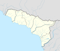
File:Abkhazia Locator map.svg
外觀

此 SVG 檔案的 PNG 預覽的大小:718 × 599 像素。 其他解析度:288 × 240 像素 | 575 × 480 像素 | 920 × 768 像素 | 1,227 × 1,024 像素 | 2,454 × 2,048 像素 | 3,058 × 2,552 像素。
原始檔案 (SVG 檔案,表面大小:3,058 × 2,552 像素,檔案大小:209 KB)
檔案歷史
點選日期/時間以檢視該時間的檔案版本。
| 日期/時間 | 縮圖 | 尺寸 | 使用者 | 備註 | |
|---|---|---|---|---|---|
| 目前 | 2013年8月13日 (二) 02:02 |  | 3,058 × 2,552(209 KB) | Iguacu | Reverted to version as of 05:56, 1 February 2010 sites hosted by Narod.ru are not actually reliable sources. |
| 2013年6月25日 (二) 17:41 |  | 3,058 × 2,552(209 KB) | Chipmunkdavis | Rv unexplained change removing an administrative division | |
| 2013年6月18日 (二) 18:38 |  | 3,058 × 2,552(207 KB) | Giorgi Balakhadze | Reverted to version as of 11:02, 31 January 2010 | |
| 2013年4月27日 (六) 21:48 |  | 3,058 × 2,552(209 KB) | PlatonPskov | Уточение границ Ткуарчалского и Галского районов http://www.ethno-kavkaz.narod.ru/ETHNO-CAUCASUS.files/Abkhaziaabkh2011.png | |
| 2010年2月1日 (一) 05:56 |  | 3,058 × 2,552(209 KB) | Iguacu | small changes | |
| 2010年1月31日 (日) 13:17 |  | 3,058 × 2,552(209 KB) | Iguacu | one more little correction. | |
| 2010年1月31日 (日) 12:46 |  | 3,058 × 2,552(209 KB) | Iguacu | + borders of Tkurchal District | |
| 2010年1月31日 (日) 11:02 |  | 3,058 × 2,552(207 KB) | Iguacu | {{Information |Description={{en|1=Locator map of Abkhazia}} |Source=File:Карта_Абхазии_обзорная.svg |Author=originally by Dinamik, modified by Iguacu |Date=31-I-2010 |Permission=see below |other_ve |
檔案用途
全域檔案使用狀況
以下其他 wiki 使用了這個檔案:
- af.wikipedia.org 的使用狀況
- an.wikipedia.org 的使用狀況
- ar.wikipedia.org 的使用狀況
- ast.wikipedia.org 的使用狀況
- av.wikipedia.org 的使用狀況
- az.wikipedia.org 的使用狀況
- ba.wikipedia.org 的使用狀況
- bn.wikipedia.org 的使用狀況
- bs.wikipedia.org 的使用狀況
- ce.wikipedia.org 的使用狀況
- cs.wikipedia.org 的使用狀況
檢視此檔案的更多全域使用狀況。

