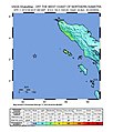
File:USGS map of the 2012 Indian Ocean Earthquake.jpg
外观

本预览的尺寸:512 × 600像素。 其他分辨率:205 × 240像素 | 612 × 717像素。
原始文件 (612 × 717像素,文件大小:69 KB,MIME类型:image/jpeg)
文件历史
点击某个日期/时间查看对应时刻的文件。
| 日期/时间 | 缩略图 | 大小 | 用户 | 备注 | |
|---|---|---|---|---|---|
| 当前 | 2016年3月13日 (日) 17:15 |  | 612 × 717(69 KB) | Dawnseeker2000 | Newer map that more closely reflects the actual felt intensities of this extraordinarily large strike-slip event. The USGS states that the maximum intensity was VII (''Very strong'') at Banda Aceh and Meulaboh, and VI (''Strong'') at Padang. |
| 2012年4月11日 (三) 12:36 |  | 612 × 717(69 KB) | YuMaNuMa |
文件用途
以下页面使用本文件:
全域文件用途
以下其他wiki使用此文件:
- ar.wikipedia.org上的用途
- be.wikipedia.org上的用途
- de.wikipedia.org上的用途
- en.wikipedia.org上的用途
- fi.wikipedia.org上的用途
- fr.wikipedia.org上的用途
- id.wikipedia.org上的用途
- ja.wikipedia.org上的用途
- ml.wikipedia.org上的用途
- ms.wikipedia.org上的用途
- pl.wikipedia.org上的用途
- pt.wikipedia.org上的用途
- ru.wikipedia.org上的用途
- si.wikipedia.org上的用途
- sv.wikipedia.org上的用途
- tr.wikipedia.org上的用途
- uk.wikipedia.org上的用途


