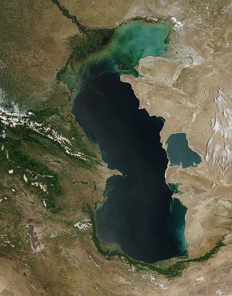
File:Caspian Sea from orbit.jpg
外观

本预览的尺寸:471 × 599像素。 其他分辨率:188 × 240像素 | 377 × 480像素 | 603 × 768像素 | 804 × 1,024像素 | 1,609 × 2,048像素 | 4,400 × 5,600像素。
原始文件 (4,400 × 5,600像素,文件大小:3.44 MB,MIME类型:image/jpeg)
文件历史
点击某个日期/时间查看对应时刻的文件。
| 日期/时间 | 缩略图 | 大小 | 用户 | 备注 | |
|---|---|---|---|---|---|
| 当前 | 2010年6月14日 (一) 09:16 |  | 4,400 × 5,600(3.44 MB) | Originalwana | higher res |
| 2005年2月8日 (二) 15:10 |  | 550 × 700(67 KB) | Pixeltoo | Caspian sea by space Nasa |
文件用途
以下5个页面使用本文件:
全域文件用途
以下其他wiki使用此文件:
- af.wikipedia.org上的用途
- als.wikipedia.org上的用途
- am.wikipedia.org上的用途
- ang.wikipedia.org上的用途
- an.wikipedia.org上的用途
- arc.wikipedia.org上的用途
- ar.wikipedia.org上的用途
- بحر قزوين
- ويكيبيديا:صور مختارة/الفضاء والكون/نظرة إلى الخلف
- ويكيبيديا:ترشيحات الصور المختارة/بحر قزوين
- ويكيبيديا:صورة اليوم المختارة/ديسمبر 2016
- قالب:صورة اليوم المختارة/2016-12-23
- مستخدم:قائمة أكبر البحيرات والبحار في المجموعة الشمسية
- ويكيبيديا:صورة اليوم المختارة/يوليو 2020
- قالب:صورة اليوم المختارة/2020-07-16
- ويكيبيديا:صورة اليوم المختارة/يوليو 2023
- قالب:صورة اليوم المختارة/2023-07-26
- arz.wikipedia.org上的用途
- ast.wikipedia.org上的用途
- as.wikipedia.org上的用途
- av.wikipedia.org上的用途
- azb.wikipedia.org上的用途
- az.wikipedia.org上的用途
- bat-smg.wikipedia.org上的用途
- be.wikipedia.org上的用途
- bew.wikipedia.org上的用途
- bg.wikipedia.org上的用途
- bh.wikipedia.org上的用途
- bn.wikipedia.org上的用途
- br.wikipedia.org上的用途
- bs.wikipedia.org上的用途
- bxr.wikipedia.org上的用途
- ca.wikipedia.org上的用途
- ce.wikipedia.org上的用途
- ckb.wikipedia.org上的用途
- co.wikipedia.org上的用途
- cs.wikipedia.org上的用途
查看此文件的更多全域用途。


