跳转到内容

File:Roman Empire 125.png

页面内容不支持其他语言。
这个文件来自维基共享资源
维基百科,自由的百科全书

原始文件 (2,186 × 1,817像素,文件大小:4.43 MB,MIME类型:image/png


相机位置45° 00′ 00″ 北, 20° 00′ 00″ 东 Kartographer map based on OpenStreetMap.在以下服务上查看本图像和附近其他图像: OpenStreetMapinfo

摘要

描述
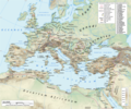
English: Map of the Roman Empire in 125 during the reign of emperor Hadrian, with anachronistic Germanic tribes from the time of Augustus.

Projection

Lambert azimuthal-equal area. Central latitude: 45° N, central longitude: 20° E. X, Y origin offset - 0

Datum: ETRS89

Sources

The physical map was made using the following public domain sources:

Additional references for the map content:

  • Tacitus, Germania (ca. 100)
  • Ptolemy, Geographia (ca. 140)
  • Atlante storico DeAgostini, Instituto Geografico DeAgostini, 1998. pg. 35-41.
  • Historischer Weltatlas, Dr. Walter Leisering, Marix Verlag, 2011. pg. 26-27
  • Történelmi világatlasz, Cartographia Kiadó, 2005. pg. 20-21.
  • The Penguin Historical Atlas of Ancient Rome by Christopher Scarre, Penguin Historical Atlases, 1995. pg. 81.

Software used

GIS:

Graphics editors:

日期
来源 自己的作品
作者
授权
(二次使用本文件)
Any use of this map can be made as long as you credit the author, Andrei N. (Wikipedia Commons user Andrein), and distribute the copies and derivative works under the same license as that the one stated below.
其他版本 [编辑]
File:Roman Empire 125.svg是此文件的矢量版本。 如果此文件质量不低于原点阵图,就应该将这个PNG格式文件替换为此文件。

File:Roman Empire 125.png → File:Roman Empire 125.svg

更多信息请参阅Help:SVG/zh

其他语言
Alemannisch  Bahasa Indonesia  Bahasa Melayu  British English  català  čeština  dansk  Deutsch  eesti  English  español  Esperanto  euskara  français  Frysk  galego  hrvatski  Ido  italiano  lietuvių  magyar  Nederlands  norsk bokmål  norsk nynorsk  occitan  Plattdüütsch  polski  português  português do Brasil  română  Scots  sicilianu  slovenčina  slovenščina  suomi  svenska  Tiếng Việt  Türkçe  vèneto  Ελληνικά  беларуская (тарашкевіца)  български  македонски  нохчийн  русский  српски / srpski  татарча/tatarça  українська  ქართული  հայերեն  বাংলা  தமிழ்  മലയാളം  ไทย  한국어  日本語  简体中文  繁體中文  עברית  العربية  فارسی  +/−
新SVG图片

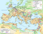
General map
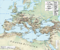
Political map

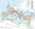
Similar maps: [编辑]

许可协议

我,本作品著作权人,特此采用以下许可协议发表本作品:
w:zh:知识共享
署名 相同方式共享
您可以自由地:
  • 共享 – 复制、发行并传播本作品
  • 修改 – 改编作品
惟须遵守下列条件:
  • 署名 – 您必须对作品进行署名,提供授权条款的链接,并说明是否对原始内容进行了更改。您可以用任何合理的方式来署名,但不得以任何方式表明许可人认可您或您的使用。
  • 相同方式共享 – 如果您再混合、转换或者基于本作品进行创作,您必须以与原先许可协议相同或相兼容的许可协议分发您贡献的作品。
GNU head 已授权您依据自由软件基金会发行的无固定段落及封面封底文字(Invariant Sections, Front-Cover Texts, and Back-Cover Texts)的GNU自由文件许可协议1.2版或任意后续版本的条款,复制、传播和/或修改本文件。该协议的副本请见“GNU Free Documentation License”。
您可以选择您需要的许可协议。
Maps of the history of Europe
BCE
aC

Weichselian ice age (c. 113,000–9700) · Neolithic expansion (c. 7000–4500) · Middle Neolithic (c. 4500–4000) · Late Neolithic (c. 4000–3000) · Copper Age – Corded Ware culture (c. 2900–2350) · Copper Age – Bellbeaker culture (c. 2800–1800) · Early Bronze Age – Unetice culture (c. 2300–1600) · Late Bronze Age – Urnfield culture (c. 1300—750) · Migrations (c. 1000–100) · Hallstatt & La Tène cultures (c. 800–100) · Roman Republic (510–40) · 220 · 218 · 200 · 201–100 · 58 · 49 · 39 · 30 BCE–6 CE


CE
dC

14 · 14–37 · 60 · 60 · 69 · 80 · Migrations 100–500 · 117 · 117 · 125 · Migrations 150–774 · Economy 180 · 271 · 293–305 · 337 · 395 · c. 395 · 400 · 400 · 450 · 457–61 · 476 · 480 · Franks 481–814 · Early Slavs 500–700 · 500 · 526 · 526–600 · Christianisation to 600 · c. 550 · 650 · Pontic Steppe 650 · 665 · 800 · Vikings 800–1050 · 814 · 843–70 · 850 · 900 · 912 · 998 · 1000 · 1000 · 1054 · 1092 · First Crusade 1095–99 · 1097 · 1135 · 1142 · 1147–49 · 1190 · 1190 · 1250 · c. 1250 · 1301-1400 · 1301-1400 · 1328 · 1345 · Black Plague 1347–51 · 1360 · 1400 · Trade routes c. 1400 · 1430 · 1470 · 1490 · 1492 · 1500 · 1519 · 1550 · 1560 · Religion 1560 · Religion 1600 · Religion 1618 · 1618–48 · 1648 · 1683 · 1700 · 1701 · 1708 · 1714 · 1721 · 1725–30 · 1739–1740 · 1740 · 1748–66 · 1783–1792 · 1787 · 1787 · 1789 · 1799 · 1812 · 1812 · 1812 · 1812 · 1813 · 1815 · 1815 · 1815 · 1818 · Ottoman Empire 1830–1923 · 1848–49 · 1861 · 1867 · 1871 · 1878 · 1890 · 1905 · 1911 · 1914 · 1914 · 1919 · 1919–29 · 1923 · 1929 · 1930 · 1940 · 1941–42 · 1942–45 · Cold War 1947–91 · 1950 · 1993–2006 · 2006 to date

(this template: · view · discuss )

说明

添加一行文字以描述该文件所表现的内容
The Roman empire under Hadrian (ruled 117–138) showing the location of roads, cities, provincial boundaries, naval bases, the Roman legions deployed in AD 125 and Germanic tribes from the time of Augustus

此文件中描述的项目

描绘内容

文件来源 简体中文(已转写)

上传者的原创作品 简体中文(已转写)

视角坐标 简体中文(已转写)

45°0'0.000"N, 20°0'0.000"E

文件历史

点击某个日期/时间查看对应时刻的文件。

最新 | 最早) 查看(较新10条 | )(10 | 20 | 50 | 100 | 250 | 500
日期/时间缩⁠略⁠图大小用户备注
当前2019年1月12日 (六) 19:342019年1月12日 (六) 19:34版本的缩略图2,186 × 1,817(4.43 MB)ArdadNThis purpose of this map is not to represent ancient shorelines. Please upload a separate file with your original contributions!
2018年9月17日 (一) 16:182018年9月17日 (一) 16:18版本的缩略图2,186 × 1,817(4.37 MB)Julieta39Shorelines of the time (Westermann Grosser Atlas zur Weltgeschichte, Braunschweig 1985, p. 36, 38, 39, ISBN 3-14-10-0919-8 and Andrein' s [https://commons.wikimedia.org/wiki/File:Danube_Delta_evolution.gif] since L. Giosan).
2015年7月20日 (一) 18:162015年7月20日 (一) 18:16版本的缩略图2,186 × 1,817(4.43 MB)ArdadN1
2015年7月20日 (一) 17:492015年7月20日 (一) 17:49版本的缩略图2,186 × 1,817(4.43 MB)ArdadN1
2015年3月3日 (二) 18:472015年3月3日 (二) 18:47版本的缩略图2,186 × 1,817(4.43 MB)ArdadNfixing text problems
2015年3月3日 (二) 17:062015年3月3日 (二) 17:06版本的缩略图2,186 × 1,817(4.38 MB)ArdadNnew road added
2015年2月10日 (二) 13:262015年2月10日 (二) 13:26版本的缩略图2,186 × 1,817(4.43 MB)ArdadN1
2014年5月20日 (二) 18:452014年5月20日 (二) 18:45版本的缩略图2,186 × 1,817(4.43 MB)ArdadN1
2014年4月9日 (三) 18:202014年4月9日 (三) 18:20版本的缩略图2,186 × 1,817(4.43 MB)ArdadNScotti
2014年3月30日 (日) 15:392014年3月30日 (日) 15:39版本的缩略图2,186 × 1,817(4.43 MB)ArdadN1
最新 | 最早) 查看(较新10条 | )(10 | 20 | 50 | 100 | 250 | 500

以下3个页面使用本文件:

全域文件用途

以下其他wiki使用此文件:

查看此文件的更多全域用途

元数据