
File:North Lanarkshire UK location map.svg

此SVG文件的PNG预览的大小:509 × 599像素。 其他分辨率:204 × 240像素 | 408 × 480像素 | 653 × 768像素 | 870 × 1,024像素 | 1,740 × 2,048像素 | 1,176 × 1,384像素。
原始文件 (SVG文件,尺寸为1,176 × 1,384像素,文件大小:1.14 MB)
| 描述 |
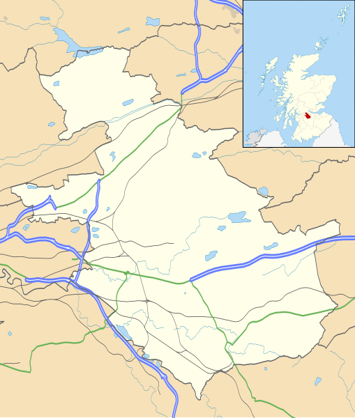
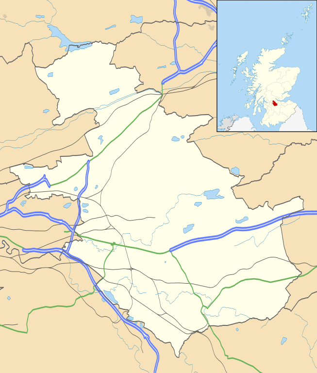
Blank map of North Lanarkshire, UK with the following information shown:
Equirectangular map projection on WGS 84 datum, with N/S stretched 175% Geographic limits:
|
| 日期 | |
| 来源 |
|
| 作者 | Nilfanion, created using Ordnance Survey data |
| 授权 (二次使用本文件) |
本文件采用知识共享署名-相同方式共享 3.0 未本地化版本许可协议授权。 署名: Contains Ordnance Survey data © Crown copyright and database right
|
| 其他版本 | File:North Lanarkshire UK blank map.svg - Blank map |
文件历史
点击某个日期/时间查看对应时刻的文件。
| 日期/时间 | 缩略图 | 大小 | 用户 | 备注 | |
|---|---|---|---|---|---|
| 当前 | 2025年1月7日 (二) 17:43 | | 1,176 × 1,384(1.14 MB) | Elianfoo | Updated with urban areas extracted from the council area location maps: Glasgow City, Stirling, South Lanarkshire and Falkirk |
| 2010年9月26日 (日) 20:20 |  | 1,176 × 1,384(1.14 MB) | Nilfanion | {{Information |Description=Blank map of North Lanarkshire, UK with the following information shown: *Administrative borders *Coastline, lakes and rivers *Roads and railways *Urban areas Equirectangular map projection on WGS 84 dat |
文件用途
以下2个页面使用本文件:
全域文件用途
以下其他wiki使用此文件:
- ar.wikipedia.org上的用途
- bg.wikipedia.org上的用途
- ceb.wikipedia.org上的用途
- de.wikipedia.org上的用途
- en.wikipedia.org上的用途
- Airdrie, North Lanarkshire
- North Lanarkshire
- Motherwell
- Coatbridge
- Kilsyth
- Wishaw
- Fir Park
- Bellshill
- Cleland, North Lanarkshire
- Bargeddie
- Excelsior Stadium
- Calderbank
- Wishaw F.C.
- Abronhill
- Condorrat
- Greenfaulds
- Millerston
- Harthill, Scotland
- Shotts
- Newarthill
- Carfin
- Black Hill transmitting station
- Croy, North Lanarkshire
- Plains, North Lanarkshire
- Cambusnethan
- Coltness
- Newhouse, North Lanarkshire
- University Hospital Monklands
- Broadwood Stadium
- Kirk o' Shotts transmitting station
- Dalserf
- Auchinloch
- Holytown
- Dullatur
- Banton, North Lanarkshire
- Kelvinhead
- Castlecary
- Chryston
- Cliftonhill
- Pather
- Ravenscraig
查看此文件的更多全域用途。