南地大区
外观
(重定向自南地)
| Southland Murihiku | |
|---|---|
| 大区 | |
| Southland Region | |
 | |
 在新西兰的位置 | |
| 坐标:45°42′S 168°06′E / 45.7°S 168.1°E | |
| 国家 | |
| 岛屿 | 南岛 |
| Established | 1989年 |
| 政府所在地 | 因弗卡吉尔 |
| 二级行政区 | |
| 政府 | |
| • Chair | Nicol Horrell |
| • Deputy Chair | Lloyd McCallum |
| 面积 | |
| • 大区 | 34,357 平方公里(13,265 平方英里) |
| 人口(2017年6月)[1] | |
| • 大区 | 98,300人 |
| • 密度 | 2.86人/平方公里(7.41人/平方英里) |
| 时区 | NZST(UTC+12) |
| • 夏时制 | NZDT(UTC+13) |
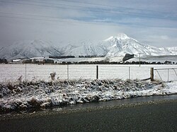
南地大区(毛利语:Murihiku,英语:Southland Region),位于新西兰最南端,管辖南地区(Southland District)和戈尔区(Gore District)两个区。大区内主要城镇有首府因弗卡吉尔(Invercargill),及戈尔(Gore)。
南地大区是新西兰人口密度最低的地区之一,因此不少自然风景得以保存而免遭破坏。区内有著名的米尔福德峡湾。
新西兰第三大岛,斯图尔特岛也位于南地大区南部。
参考文献
[编辑]- ^ 1.0 1.1 1.2 Subnational Population Estimates: At 30 June 2017 (provisional). Statistics New Zealand. 2017-10-24 [2017-10-24]. For urban areas, Subnational population estimates (UA, AU), by age and sex, at 30 June 1996, 2001, 2006-16 (2017 boundary). Statistics New Zealand. 2017-10-24 [2017-10-24].
| 这是一篇关于大洋洲地理位置的小作品。您可以通过编辑或修订扩充其内容。 |
